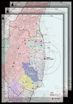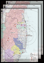
GPS MAP GRAPH I-131 Cs-137 Sr-89 Sr-90 Pu-238 Pu-239+Pu-240
- Organization
- The Ministry of Education, Culture, Sports, Science and Technology, and the Secretariat of the Nuclear Regulation Authority
- Period
- FY 2011 - FY 2014
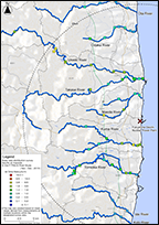
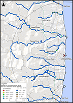
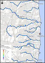
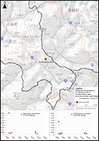
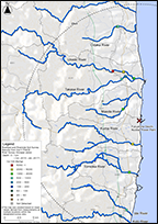
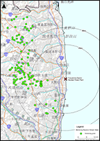
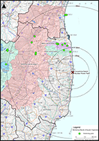
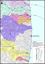
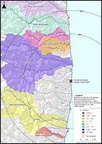
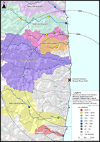
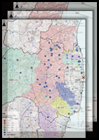
- Summary
- In order to confirm the changing trend of the concentrations of radioactive substances in the river water in Fukushima Prefecture, we conducted surveys. The analysis results show radiation (Bq) per...