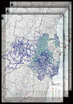
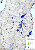
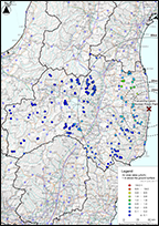
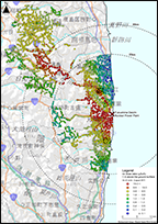
The Fukushima Prefecture Government has continuously been conducting the mesh survey with 2 km grids covering whole Fukushima Prefecture to understand the distribution of air dose rate in the whole...
The Ministry of Education, Culture, Sports, Science and Technology, and the Secretariat of the Nuclear Regulation Authority
Period
FY 2011 - FY 2016
Summary
This series of data was created based on results of the air dose rates measured using NaI(Tl) scintillation survey meters and ionization chamber type survey meters from FY 2011 to FY 2016 in the Di...
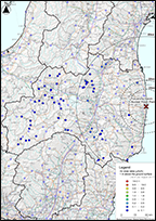
This data was created based on the measurement results of hot springs from the "Readings of Environmental Radiation Monitoring at Tourist Spots in Fukushima Prefecture" released to the public i...
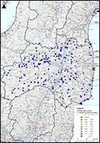
This data was created based on the measurement results of tourist spots from the "Readings of Environmental Radiation Monitoring at Tourist Spots in Fukushima Prefecture" released to the public...
The Ministry of Education, Culture, Sports, Science and Technology, and the Secretariat of the Nuclear Regulation Authority
Period
From March 2011 to October 2016
Summary
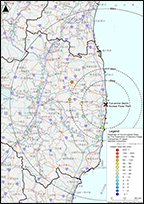
This data was created based on the "Results of Measurement of Air Dose Rates at Fixed Observation Points using a Monitoring Car" released to the public in the Monitoring Information of Envi...
The Ministry of Education, Culture, Sports, Science and Technology, and the Secretariat of the Nuclear Regulation Authority
Period
From March 2011 to March 2016
Summary
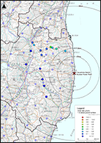
This data was created based on the "Readings of Accumulated Dose outside the 20 km Zone of TEPCO Fukushima Dai-ichi NPP" released to the public in the Monitoring Information of Environmental...
The Ministry of Education, Culture, Sports, Science and Technology, and the Secretariat of the Nuclear Regulation Authority
Period
From April 2011 to December 2016
Summary
This data was created based on the "Readings of Accumulated Dose outside the 20 km Zone of TEPCO Fukushima Dai-ichi NPP" released to the public in the Monitoring Information of Environmental ...
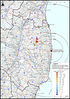
This data was created based on measurements within a 20 km radius of TEPCO Fukushima Dai-ichi NPP, available in the Monitoring Information of Environmental Radioactivity Level, the portal s...
This data was created based on the results of "Environmental Radiation Level by Emergency Monitoring by Fukushima Prefecture" released to the public in the Monitoring Information of Environment...
The Federation of Electric Power Companies of Japan (Member Companies)
Period
From March 2011 to December 2017
Summary
This data was created based on the "Readings of Accumulated Dose by The Federation of Electric Power Companies of Japan (Member Companies)" released to the public in the Monitoring Information ...
This data was created based on the results of the environmental radiation monitoring for child welfare institutions by Fukushima Prefecture released to the public in the Fukushima Prefecture Go...
This data was created based on the results of environmental radiation monitoring survey in the national forests in Fukushima Prefecture released to the public in the Kanto Forest Management Off...
National Institute of Advanced Industrial Science and Technology
Period
From March 2011 to March 2013
Summary
This data was created based on the results of air dose rates from "The Measurement Results of Air Dose Rates at Tsukuba Center" that was released to the public in the website of the National In...
The Ministry of Education, Culture, Sports, Science and Technology
Period
From June 2011 to August 2011
Summary
This data was created based on results of the monitoring survey in the restricted areas and planned evacuation zones, available in the Monitoring Information of Environmental Radioactivity Level, t...